On this page
OnlyFacts wants to make data relevant at the level that matters to you. But sometimes geography gets in the way.
Take electric vehicle (EV) registrations and solar PV installations. Both datasets are published by postcode. Yet you might want the numbers for your local government area (LGA) or electorate.
Postcode boundaries don’t align neatly with other areas. And people aren't spread evenly. A postcode might straddle two LGAs, with 90% in one and 10% in the other. You could split the data 90:10, but if the larger slice is a national park and the smaller is packed with apartments, the result will be wildly incorrect.
That's why we have developed a system to translate data across geographies.
Data that is the result of this process is labelled with a Data Provenance of: Inferred. Learn more about Data Provenance here.
Solution: Mesh blocks
Australia is carved into 151 federal electorates, 453 state electorates, 2,642 postcodes, and 15,354 suburbs. But the real workhorse is the mesh block.
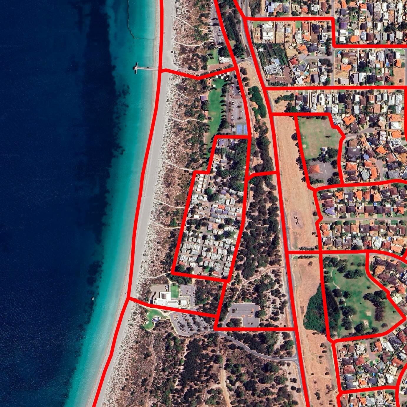
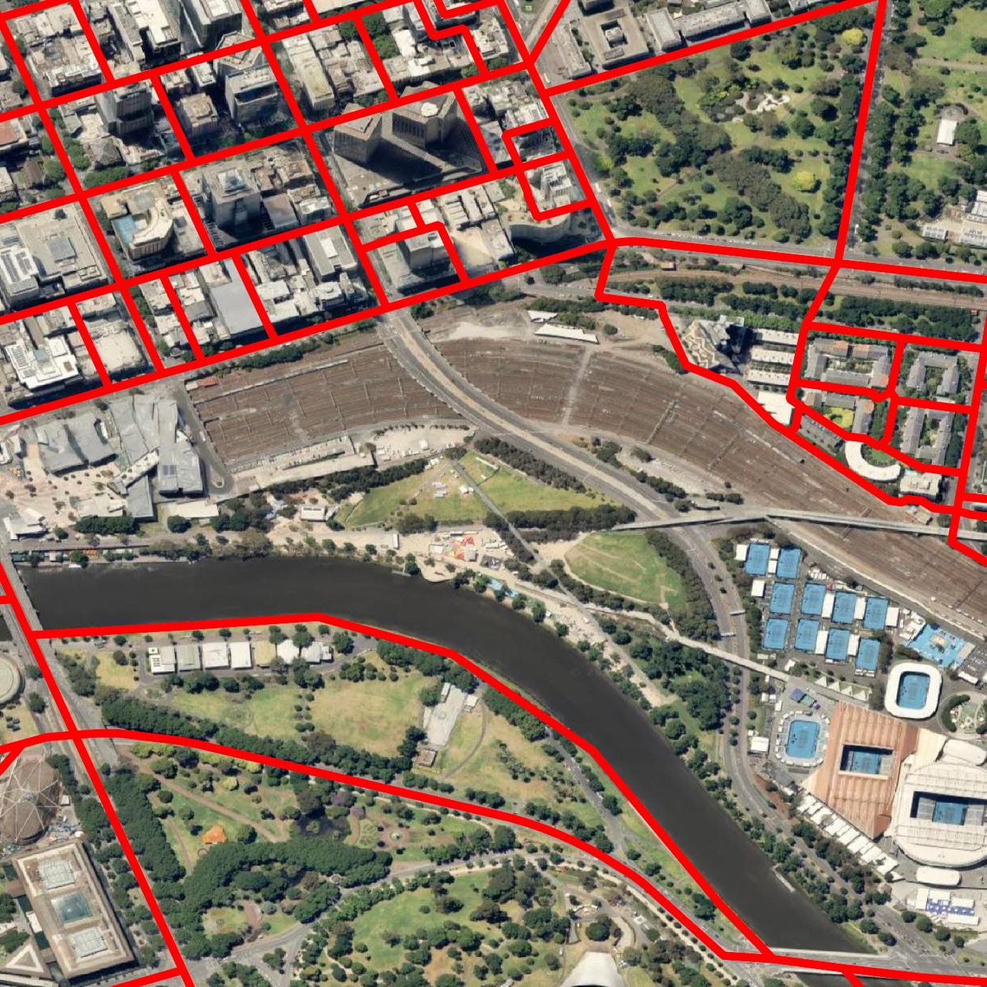
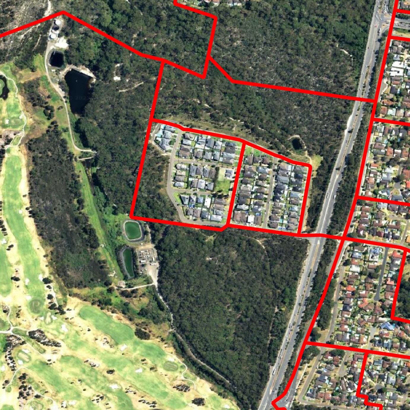
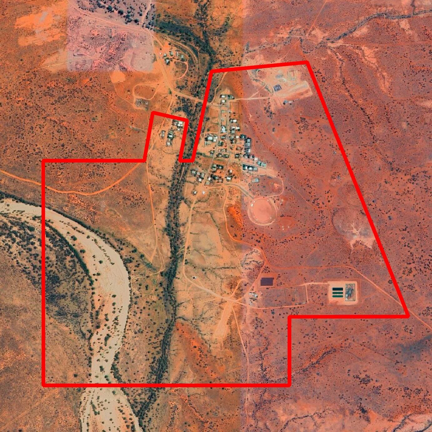
Mesh blocks are the smallest geographical unit used by the Australian Bureau of Statistics (ABS). There are 368,172 of them, covering the country ‘without gaps or overlaps.’ Residential blocks typically hold 30-60 dwellings. Others cover facilities with no residents, such as airports, warehouses, highways, hospitals, universities. And there are special blocks for people on ships, oil rigs, or sleeping rough.
Here are some mesh blocks in action, outlined in red. Note how their size and contents change.
Are you meshuga for mesh blocks? Learn more about them here.
Methodology
OnlyFacts uses mesh blocks to reconcile messy boundaries with population reality.
Each mesh block serves as a building block for larger areas, such as suburbs, postcodes, LGAs, state electorates, and federal electorates. By breaking data down to mesh blocks and reassembling it into another geography, we can translate datasets between different scenarios.
The result is not perfect. It should be treated as an informed estimate, and users should decide if the method is fit for their purpose.
To see the process in action, consider postcode 2209 in New South Wales, which covers Narwee and Beverly Hills in Sydney’s south. According to the Bureau of Infrastructure and Transport Research Economics (BITRE), 423 electric vehicles were garaged here as of January 2024.
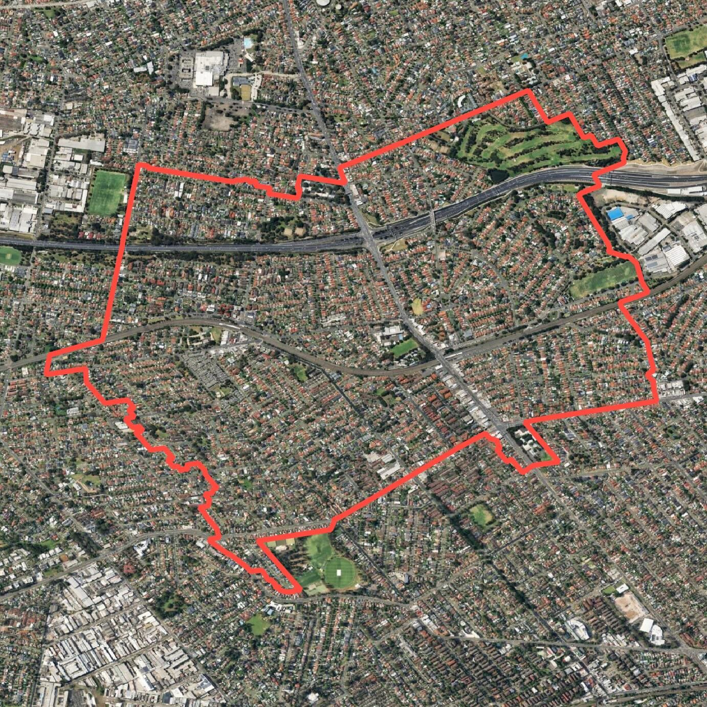
Let’s say we want to understand EV behaviour by federal electorate. Postcode 2209 spans three: Banks, Barton, and Watson.
Overlaying electoral and postcode boundaries shows 49% of the land falls in Banks, 29% in Barton, and 22% in Watson. Pro-rating the 423 EVs by land area would give Banks 208, Barton 124, and Watson 91.
But land isn’t people. Density varies, and Watson’s area includes a motorway and a golf course.
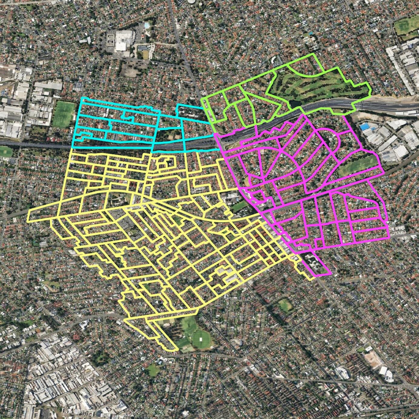
Using mesh blocks, we can distribute the EV data more accurately. Postcode 2209 breaks down into 196 mesh blocks.
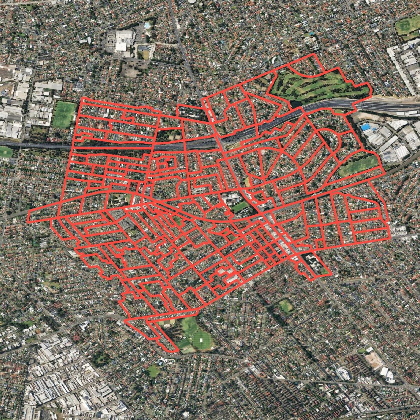
Each mesh block can be assigned cleanly to a federal electorate. In the image below, Banks appears in yellow with 127 blocks, Barton in pink with 44, and Watson in blue with 25.
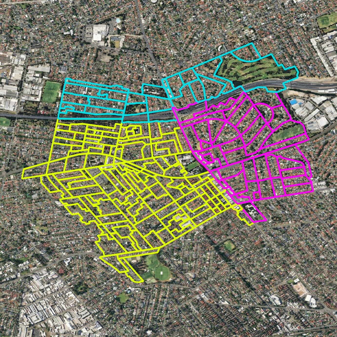
We know the population of each mesh block. By summing them, we can see how postcode 2209 divides across electorates:
- Banks: 10,054 people
- Barton: 3,636 people
- Watson: 2,100 people
Adjusting the 423 EVs by population gives 269 in Banks, 97 in Barton, and 56 in Watson.
It’s still an estimate, but one grounded in where people actually live. The same method can then be applied across every postcode in a seat to build the electorate-wide picture.
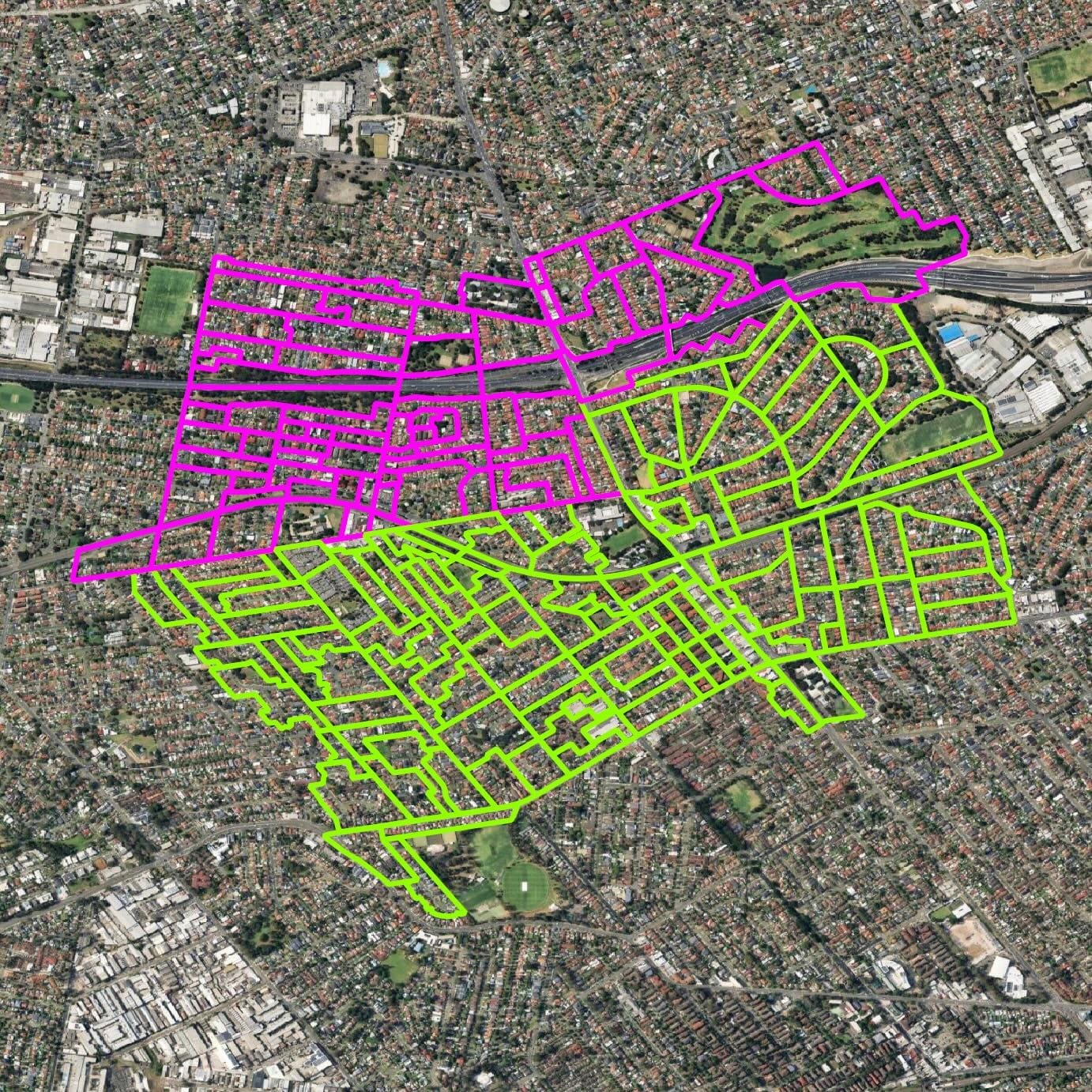
The same logic works for state electorates. Postcode 2209, for instance, stretches across four of them.
And it works for LGAs too. Postcode 2209 splits across two.
These examples show how it works when the source data is published by postcode. If the source gives data for LGAs, the same approach applies. Whatever the geography or target, mesh blocks are the common denominator.
Why It Matters
Sometimes mesh block calculations amount to little more than a rounding error. Other times, they spell the difference between a fair estimate and a complete distortion.
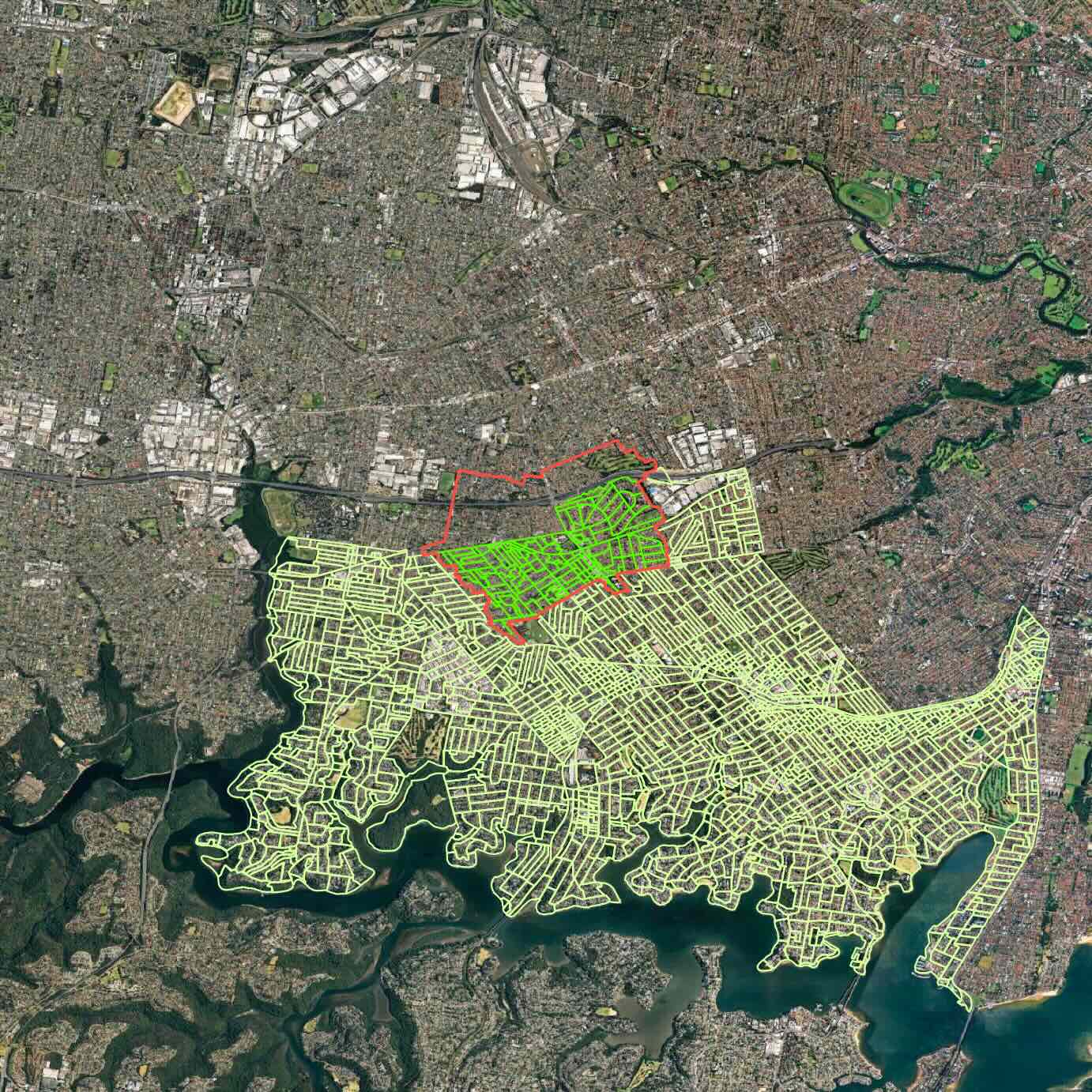
Take postcode 2880 in far-western New South Wales.
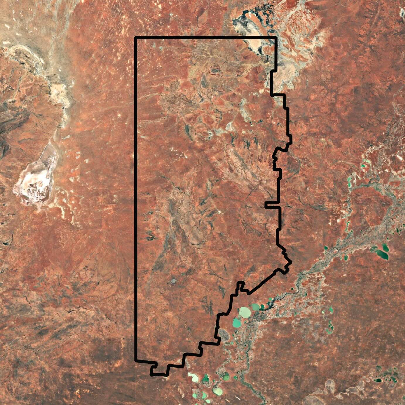
It’s almost the size of Tasmania yet home to just 18,075 people. About 97% of the population lives in Broken Hill, which sits on a tiny fraction of the postcode’s land area - a quarter of a per cent. In that sense, the postcode is a microcosm of Australia.
Using land area alone, Broken Hill (population 17,587) would have been allocated 17 rooftop solar installations, while the unincorporated area (population 488) would have been allocated 6,597.
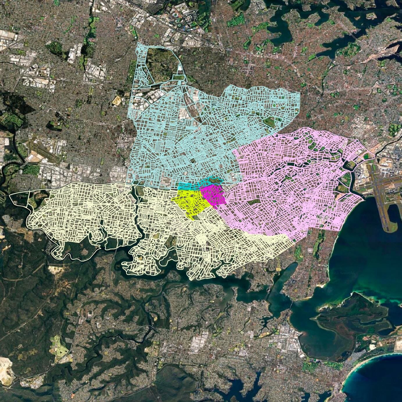
Mesh blocks fix the picture. Postcode 2880 breaks into 383 of them. In the image below, Broken Hill LGA appears in pink, while green lines mark the unincorporated areas with no local government. The small dots are mostly lakes; the larger patches capture the scattered homes outside Broken Hill and Silverton.
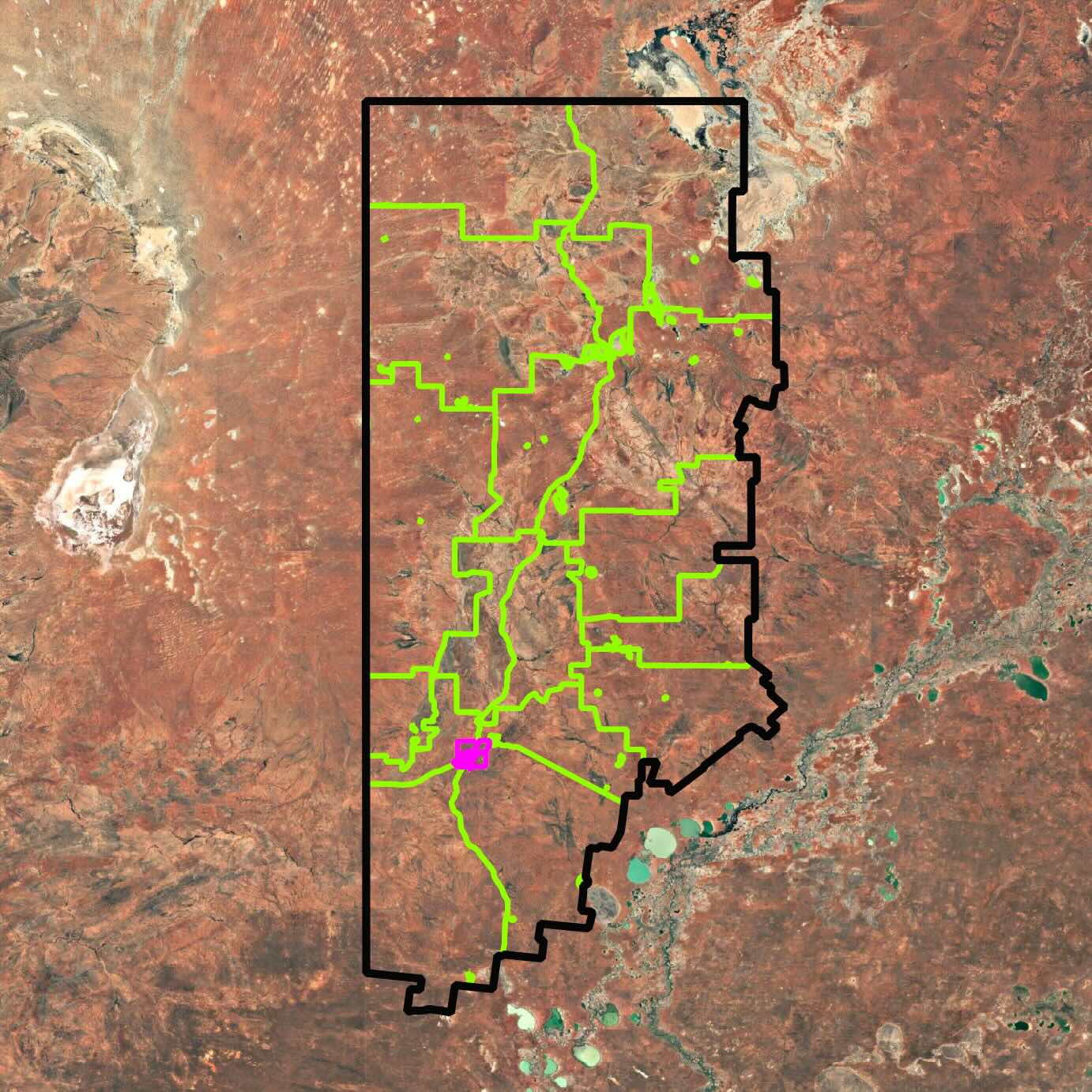
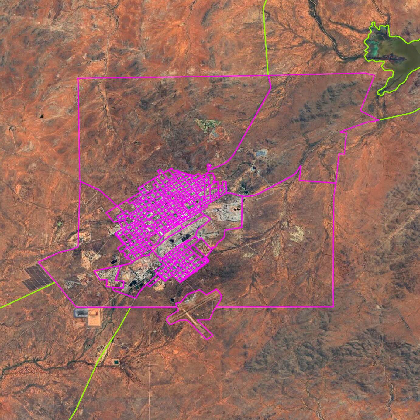
Mesh blocks pinpoint the population inside the postcode. The result is Broken Hill LGA ranks among the top 30 in Australia for solar uptake. A silver medal for a silver city.
Accuracy and Limits
Mesh blocks don’t solve everything. If a postcode is reported to have 100 solar systems, this method assumes they’re spread evenly by population. A block with 1% of the postcode’s people is assumed to host 1% of the panels.
The ABS also adjusts populations slightly in small mesh blocks to protect privacy. That means summed mesh block populations don’t always match the official figure for a postcode or electorate.
Still, mesh blocks bring us closer to reality, grounding data not in boundary lines, but in where people actually live.
Data that is the result of this process is labelled with a Data Provenance of: Inferred. Learn more about Data Provenance here.
Disclaimer: We aim for accuracy, but cannot guarantee that all data on OnlyFacts is free from error or suitable for every purpose. Always use your own judgment and seek professional advice where required.